A bootkit is a boot virus that is able to hook and patch Windows to get load into the Windows kernel, and thus getting unrestricted access to the entire computer. It is even able to bypass full volume encryption, because the master boot record (where Stoned is stored) is not encrypted. The master boot record contains the decryption software which asks for a password and decrypts the drive. This is the weak point, the master boot record, which will be used to pwn your whole system. No one’s secure!
For whom is Stoned Bootkit interesting?
Black Hats
Law enforcement agencies
Microsoft
Why is Stoned something new? Because it is the firts bootkit that..
attacks Windows XP, Sever 2003, Windows Vista, Windows 7 with one single master boot record
attacks TrueCrypt full volume encryption
has integrated FAT and NTFS drivers
has an integrated structure for plugins and boot applications (for future development)
“A bootkit is a rootkit that is able to load from a master boot record and persist in memory all the way through the transition to protected mode and the startup of the OS. It’s a very interesting type of rootkit.” – Robert Hensing about bootkits
Bhuvan gives you an easy way to experience, explore and visualize IRS images over Indian region ISRO is well known amongst space faring nations for its world-leading reputation in developing new, indigenous and innovative service oriented applications using remote sensing technology. Over the past 2 decades, ISRO has mastered the art of developing these unique applications using various spectral, spatial and temporal resolutions offered by the versatile IRS satellites and these have been successfully institutionalized in many important areas of policy making, natural resources management, disaster support, and enhancing the quality of life across all sections of the society.
Bhuvan is an initiative to showcase this distinctiveness of Indian imaging capabilities including the thematic information derived from such imagery which could be of vital importance to common man with a focus on Indian region. Bhuvan, an ambitious project of ISRO to take Indian images and thematic information in multiple spatial resolutions to people through a web portal through easy access to information on basic natural resources in the geospatial domain. Bhuvan showcases Indian images by the superimposition of these IRS satellite imageries on 3D globe. It displays satellite images of varying resolution of India’s surface, allowing users to visually see things like cities and important places of interest looking perpendicularly down or at an oblique angle, with different perspectives and can navigate through 3D viewing environment. The degree of resolution showcased is based on the points of interest and popularity, but most of the Indian terrain is covered upto at least 5.8 meters of resolution with the least spatial resolution being 55 meters from AWifs Sensor. With such rich content, Bhuvan opens the door to graphic visualisation of digital geospatial India allowing individuals to experience the fully interactive terrain viewing capabilities.
Multi-resolution images from multi-sensor IRS satellites of India is seamlessly depicted through the Bhuvan web portal by enabling a common man to zoom into specific area of interest at high resolution. Bhuvan brings a whole lot of uniqueness in understanding our own natural resources whilst presenting beautiful images and thematic vectors generated from varieties of geospatial information. Bhuvan will also attempt to bring out the importance of multi-temporal data and to highlight the changes taking place to our natural resources, which will serve as a general awareness on our changing planet. There are lot more special value added services which will be enabled onto the web portal in due course of time and each one of those services are going to be unique to preserving and conserving our precious natural resources through public participation. We are sure the common man will get rich benefits from these Indian geospatial data services in days to come.
Basic features of Bhuvan:
Access, explore and visualise 2D and 3D image data along with rich thematic information on Soil, wasteland, water resources etc.
Visualise multi-resolution, multi-sensor, multi-temporal image data
Superpose administrative boundaries of choice on images as required
Visualisation of AWS ( Automatic Weather Stations) data/information in a graphic view and use tabular weather data of user choice
Fly to locations ( Flies from the current location directly to the selected location)
Shadow Analysis (it sets the sun position based on the given time creating shadows and effects the lighting on the terrain)
There would be many more value added functions and facilities which will be added into the package from time to time.
Particular interest of ISRO/DOS would be to provide such functionalities to common man so that he/she adopts participatory approach with scientists to solve simple problems easily and interactively.
Advanced functionalities to be provided in future versions
Urban Design Tools (to build roads, junctions and traffic lights in an urban setting)
Contour map ( Displays a colorized terrain map and contour lines)
Terrain profile ( Displays the terrain elevation profile along a path)
Draw tools (Creates simples markers, free hand lines, urban designs)
Navigation map (to jump to and view locations in the 3D India)
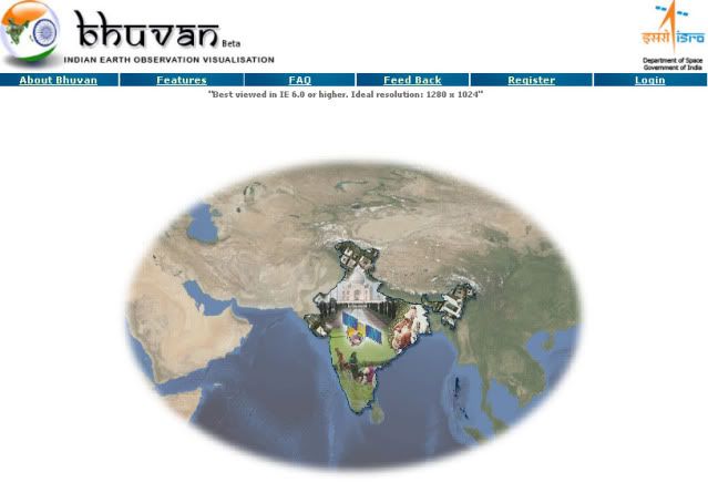
What is Bhuvan? Bhuvan is a geoportal that provides medium to high resolution satellite imagery of virtually the entire India over the internet. You can "fly" around using mouse and keyboard on a simple desktop computer with virtual globe in front draped with IRS images over Indian region. Many other features are built in, including 3D terrain and information on many thematic data.
What can Bhuvan do for me? Bhuvan is a free web based image portal. Most Image visualization programs are very expensive and complex. Bhuvan provides a fast and friendly way to look at IRS satellite data and thematic information in geographic context, which is invaluable for management, planning and visualization. Additionally, Bhuvan makes it easy to share digital data between people and computers anytime, anywhere. Over a period of time a lot more unique functionalities will be added into this tool to address common man’s problems, particularly in the rural setup of India and addressing natural resources management issues.
What do I require to run Bhuvan on my Machine? You require the Bhuvan Plug-in which can be downloaded from the Bhuvan website after registration and you will also need DirectX8 or higher version (www.microsoft.com/windows/directx/) for installing the plug-in. Please note that the Bhuvan Plug-in can be installed with administrative privileges only.
How do I use Bhuvan? When you first open Bhuvan website, You will land on the index page which gives you information on Bhuvan and this page also allows you to register for using the Bhuvan. Once you successfully register, you will land on the Bhuvan 3D client page. Here, there are three primary areas of the program that you'll be using. The main window shows a globe, and you can navigate around with your mouse or use the Heads-Up Display (HUD) option available on the right top corner. Double right click to zoom in, and double left click to zoom out (or use your mousewheel). Right click, hold, and drag to pan. The second area is at the upper right of the main window. When you move your mouse over the navigation compass, it give you more movement options such as rotate and tilt (which you can also do with your mouse). The third area is to the left of the main window. This frame includes a fly to location and fly to important places option. On the top of the globe are the menu options for layers, 2D and 3D drawing, measurement tools, snapshot tools etc. When you select any of these options, you see the context options on the left plane where you can make appropriate choices that you can turn on to make visible in the main windows such as roads, 3D terrain, and more.
Can I use Bhuvan if I don't have a fast internet connection? Yes. Bhuvan is designed to be as bandwidth-friendly as possible. However, it is dependent on continuously downloading a large amount of imagery. Consequently, the faster your connection, the better the program will perform. If you have a slow connection, Bhuvan will download imagery correspondingly slowly, but it will (eventually) download everything at the maximum available resolution. Depending on the number of concurrent users on over servers and the kind of bandwidth at client end the ultimate speed of visualisation will be decided. This is a beta release, however with more learnings we will be able to make things more comfortable for all types of users.
Can I use Bhuvan if I'm not connected to the internet? No. You will have to be connected to Internet for using Bhuvan.
How current is the imagery in Bhuvan?
Bhuvan portal does NOT display data in real-time. The images you see are a combination of satellite imagery from various IRS sensors taken (generally) sometime within the last three years during different seasons. Bhuvan, on release, contains IRS satellite images from OCM, AWifs, LISS 3, and LISS 4 sensor images and will be added with more data from time to time. Bhuvan is constantly updating its database to use more recent and higher resolution images. You can explore the metadata content to determine when exactly a specific area was imaged, but you may be able to use landmarks to generalize a date range if you are familiar with the area.
How do I bookmark a place in Bhuvan? Zoom to the location that you'd like to bookmark (placemark, more accurately), use the draw tool to place an icon. After you save the placemark, it will stay in the frame to the left of the main window, and double clicking on it will zoom you to that position.
Can I add my own data into Bhuvan? No. In the current version, you will not be able to add your own data
Do I have to register to use Bhuvan? Yes. It is mandatory to register to use Bhuvan.
How much does Bhuvan cost? The basic version of Bhuvan is free. Once you register and you login, you will be asked to download the Bhuvan plug-in. Accept the installation of the plug-in and you are ready to use the full features of Bhuvan.
What are the System Requirements for Using Bhuvan? Requirements for Windows
Operating System: Windows XP/Vista
CPU: Pentium 4 2.4GHz+ or AMD 2400xp+
System Memory (RAM): 512MB
Hard Disk: 2GB free space
Network Speed: 768 Kbits/sec
Graphics Card: 3D-capable with 32MB of VRAM
Screen: 1280x1024, "32-bit True Color"
Can I run Bhuvan on Mac OS and Linux? No at the moment Bhuvan can run only on windows system and is optimised for IE 6. or higher
What type of data can I see in Bhuvan? You will be able to see the following data on Bhuvan
Satellite imagery (LISS III , LISS IV along with metadata and Multi- temporal Data from OCM & AWiFS)
Value added information (NADAMS – National Agricultural Drought Monitoring System), Output of flood studies for certain areas,
Thematic information (Wastelands, Soils, watershed,water resources related maps)
Base layers ( administrative boundaries, transport layers, water bodies, etc)
Census information
Metadata
What do I do when I get the ‘’DD_ERR Video Ram Memory’’ error? Close all other applications and relaunch Bhuvan.
The Indian Space Research Organisation (ISRO) official website of Indian Earth Observation and Visualization is www.bhuvan.nrsc.gov.in, Today (12 August, 2009) the Beta web 3D tool announced. It is very useful to anybody see the full coverage of Indian Region. The web tool is discover and explore earth in 3D space with specific emphasis on Indian region.
Minister of State in the PMO Prithviraj Chavan launched the beta version of the geoportal www.bhuvan.nrsc.gov.in on Today. It is day-long workshop of the Astronautical Society of India on "21st Century Challenges in Space -- Indian Context."
If you like to use this tool, Firstregister free account via Bhuvan official website. After user login to get to use Indian 3D Mapping Tool. It is similar to Google Earth. The Bhuvan web portal that allowed all to zoom into specific area of interest at high resolution.